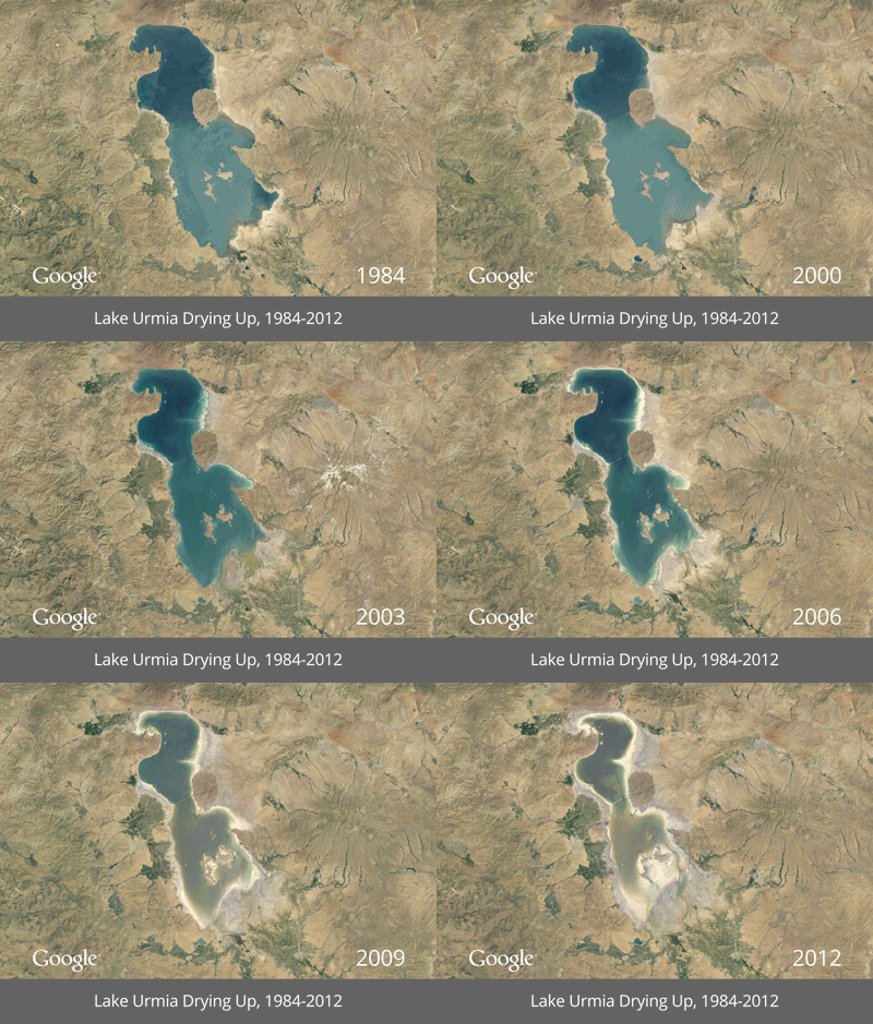
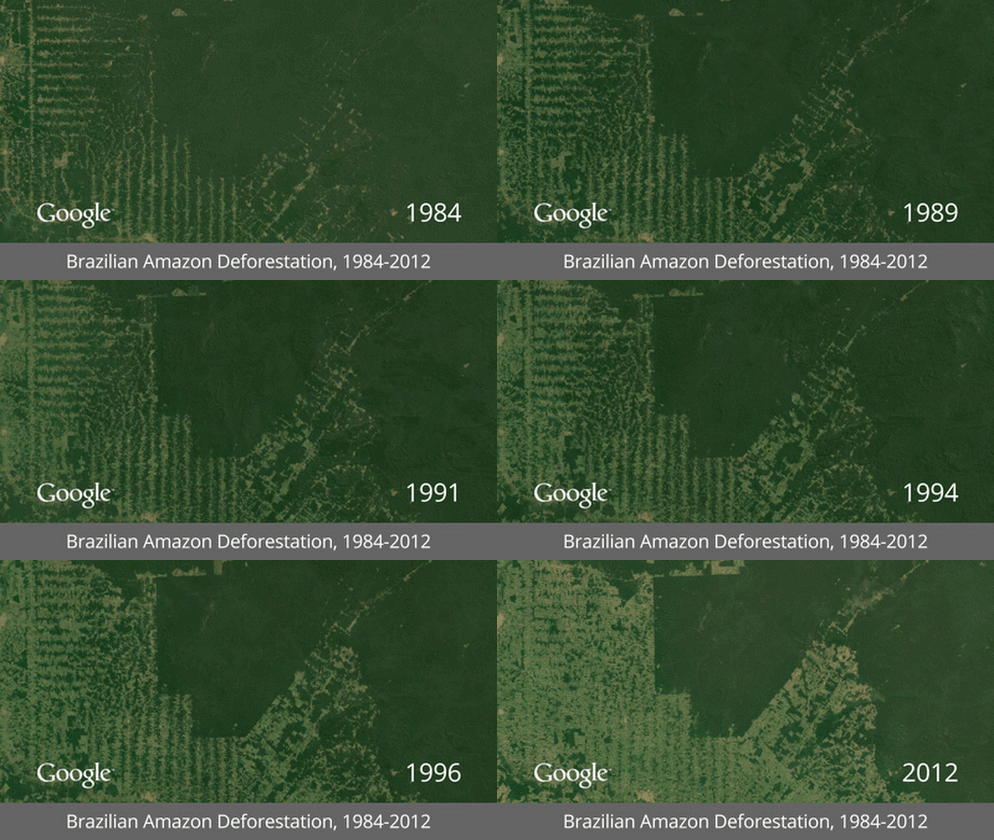
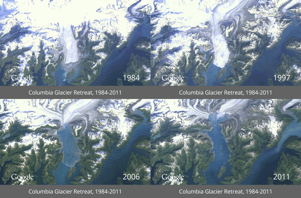
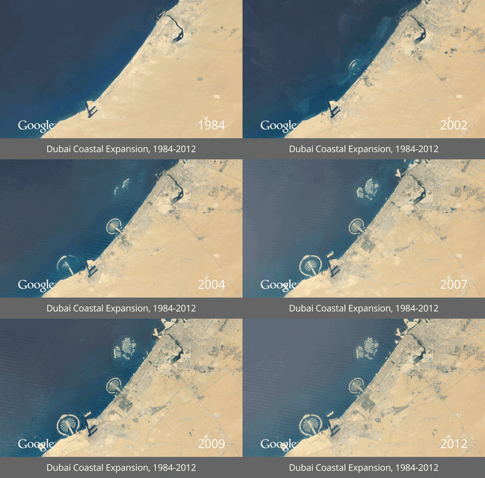
It is said that, “A picture is worth a thousand words,” . This saying is particularly true for recently launched Google project called “timelapse”. The time-lapse satellite images of the past 28 years have been used to show how the expansion and development of the human race is impacting the Earth. The rapid urbanization, shrinking of glaciers and lakes due to global warming, exploitation of natural resources, all is very well evident from these animated photographs.
1. The drying up of Lake Urmia (Iran)
2. Deforestation in the Amazon (Brazil)
3. Decline in Columbia Glacier (Alaska, USA)
4. Urban Expansion of Dubai (United Arab Emirates)
5. The development of irrigation (Saudi Arabia)
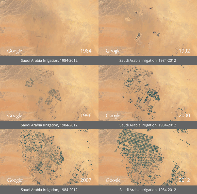
6. The operation of a Coal Mine (Wyoming, USA)
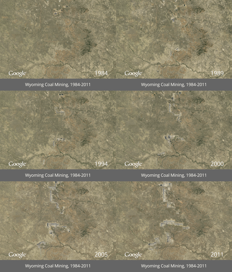
7. Urban Expansion in Las Vegas … and the drying up of Lake Mead (Nevada, USA)
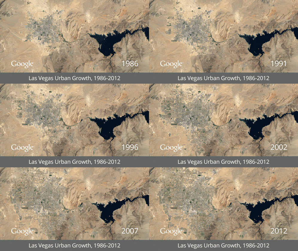
8. The drying of the Aral Sea (Kazakhstan)
(Source: Google Earth Engine)